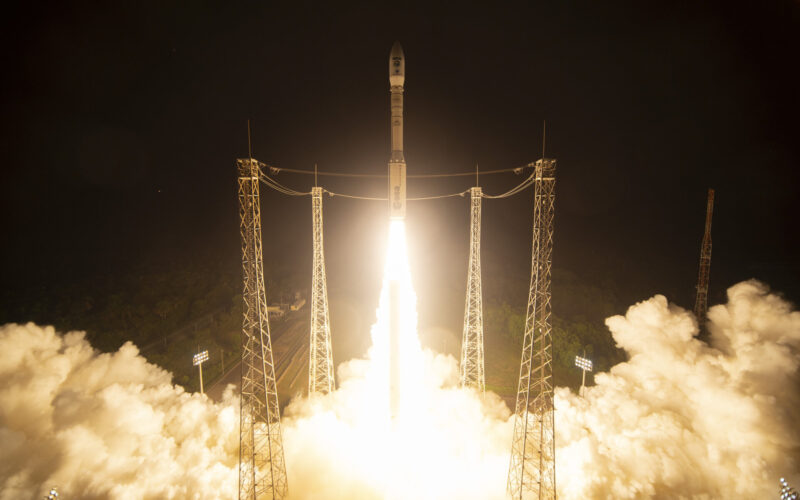
The third Copernicus Sentinel-2 satellite has been successfully launched on the final Vega rocket from Europe’s Spaceport in Kourou, French Guiana.
In a press release, published on September 5, 2024, the European Space Agency (ESA) said the satellite will provide high-resolution data for Copernicus, Europe’s Earth observation program.
Sentinel-2C launched into orbit on September 5, 2024, at 03:50 local time and separated from the Vega rocket at approximately 04:48 local time. Around 14 minutes later, at 05:02 local time, ESA received a signal confirming the satellite was safely in orbit.
Sentinel-2C, manufactured by Airbus, will enter service in low Earth orbit at 780 kilometers. It will soon replace its predecessor Sentinel-2A, which is set to retire, while Sentinel-2B will continue to operate alongside it.
“This launch gives the world another important sensor to monitor our changing planet and provides crucial continuity since the first Sentinel-2 satellite launch in 2015,” said Marc Steckling, Head of Earth Observation, Science and Exploration at Airbus, said in a press release. “The satellite will collect vital imagery for a myriad of applications from agriculture to water quality monitoring.”
“This mission further confirms the role of Copernicus as a leading programme to contribute to climate change and environmental challenges worldwide, but also ensures the continuity of vital data to support agriculture, forestry, maritime monitoring, and for many other sectors,” added Simonetta Cheli, ESA’s Director of Earth Observation Programmes.
What is the Copernicus Sentinel-2 mission?
The Sentinel-2 mission satellites monitor Earth’s agriculture and water quality as well as natural disasters, including floods, wildfires, and volcanic eruptions. It consists of two identical satellites that travel in the same orbit, but 180° apart.
These satellites orbit the Earth every 100 minutes, capturing images of all land areas, large islands, and inland and coastal waters every five days. Orbiting at 786 kilometers high, the satellite offers ongoing images in 14 spectral bands with resolutions of 10 m, 20 m and 60 m. Sentinel-2 satellites can collect 1.5 terabytes of data per day.
The Sentinel satellites are part of Copernicus, the Earth Observation component of the EU Space Programme, which is managed by the European Commission (EC) and ESA.

